 Built In Oasis
Multi-layer AI system that detects mispriced real estate assets before market correction.
Research System
AID — Aerial Inspection Intelligence System
Simulated multi-engine platform for autonomous drone roof inspection, damage detection, and insurance-claim intelligence.
What it solves
Roof inspections are manual, hazardous, and inconsistent, and the damage assessments they produce are hard to trust for insurance and repair decisions. There is rarely a guarantee that a roof was fully and reliably observed, so coverage gaps and low-confidence findings slip through. Turning captured imagery into defensible cost estimates, claim-eligibility calls, and delivery-ready reports normally requires stitching together many disconnected steps.
Built for Roof-inspection, insurance, and property-assessment operators evaluating autonomous drone inspection.
Overview
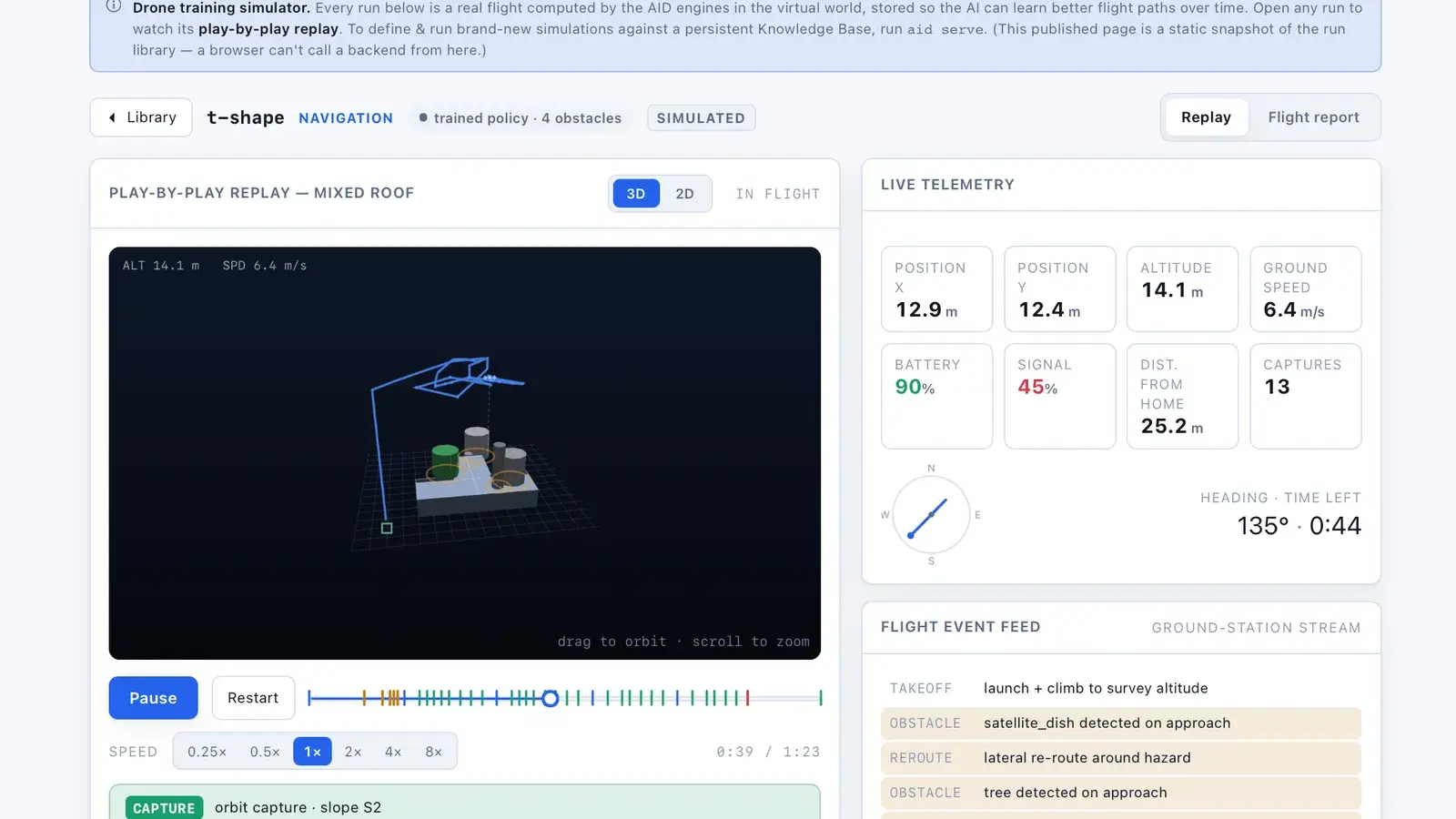
AID is a runnable, offline skeleton of an autonomous drone roof-inspection platform organized as nine coordinated engines bound by a master orchestrator. A mission flows through a fixed pipeline — mission planning, spatial reconstruction, flight execution, computer-vision damage detection, uncertainty and coverage validation, risk and insurance analysis, and reporting — advancing a seven-state mission machine. Several engines are genuine computation: mission planning uses 2D computational geometry to infer roof planes and generate coverage flight paths, coverage is geometrically measured rather than assumed, spatial mapping reconstructs a 3-D digital twin from camera poses, damage runs through a classical computer-vision detector, and risk and insurance produces real construction-cost bands (P10/P50/P90), RCV/ACV depreciation, and claim-eligibility scoring. An orchestrator enforces integrity rules — no orphan data, an uncertainty gate that blocks reporting and triggers re-inspection, and a safety override. It ships a REST API, a SQLite-backed mission store, a fleet scheduler, multi-format report rendering, a Gym-style RL environment, and an operations console UI.
What this demonstrates
It builds a strictly sequenced multi-engine pipeline over shared, schema-validated data contracts, with an orchestrator that enforces integrity rules, an uncertainty gate that measurably blocks and loops re-inspection, and a safety override. The hard engineering is real: 2D roof-plane geometry with pitch-corrected areas and occlusion, geometric coverage measurement via polygon unions, a camera-pose-driven 3-D reconstruction, a classical CV detector computing bounding boxes from pixels, and an actuarial cost/claim model with P10/P50/P90 bands. Real-world dependencies (imagery, ML models, GIS, weather, flight hardware) sit behind swappable adapter interfaces so each can be dropped in by replacing a single run() body.
What makes it different
Most drone systems fly cameras and hope the footage is enough. This one treats space as truth, not the image — reconstructing grounded 3D roof reality first, scoring its own confidence, and letting flight safety override every intelligence decision, so no inspection is 'done' until completeness is proven.
- Safety overrides intelligenceNo AI decision may violate physical safety, regulatory limits, or obstacle avoidance; flight safety always outranks mission completion and optimization.
- Image is not truth — space is truthImages are noisy projections; the system reconstructs stable spatial reality from unstable visual inputs before any reasoning.
- Structure precedes interpretationNo damage detection is valid until geometry is confirmed and slope boundaries are defined.
- Confidence is a first-class outputEvery prediction carries detection, visibility, classification, and spatial confidence scores.
- Uncertainty is a first-class data objectUncertainty is measurable, trackable, and actionable — not noise to be ignored.
- Assume incompleteness until proven otherwiseEvery inspection is treated as incomplete until all regions meet minimum observation confidence thresholds.
- Damage is not financial valueA detected issue is not automatically claimable or costly; it must be translated through insurance and repair economics.
- Reports are legal evidence systemsEvery conclusion must trace to image evidence, spatial coordinates, and confidence scores — defensibility over persuasion.
- Distributed intelligence, no single point of failureA network of specialized engines under a deterministic control layer; no module can finalize output alone.
- Optimization is global, not localThe fleet is a compute resource; missions are optimized against fleet load, regional demand, and weather, not in isolation.
Core engines · 9
Mission Planning EngineInformation-first planning
Converts property geometry and inspection mode into an uncertainty-minimized 3D observation strategy — inferring roof structure, segmenting slopes, and generating multi-pass coverage plans.
Spatial Mapping EngineDigital roof twin
Reconstructs a queryable 3D roof model from multi-angle drone imagery using camera pose estimation, multi-view fusion, and occlusion mapping.
Flight Control SystemSafety override
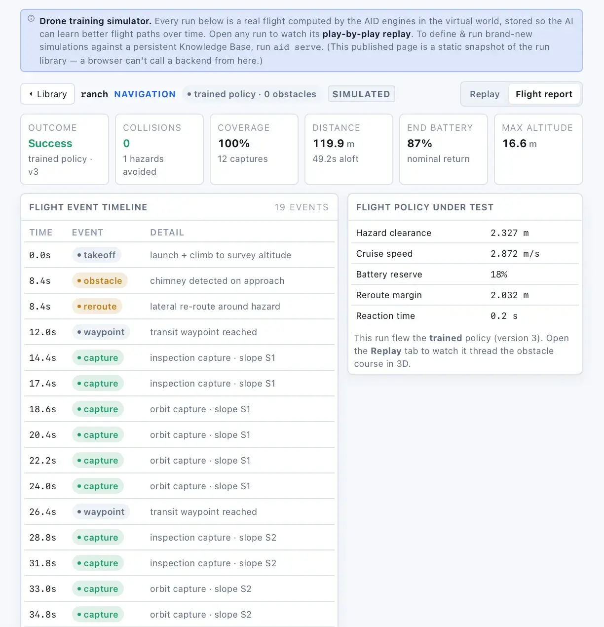
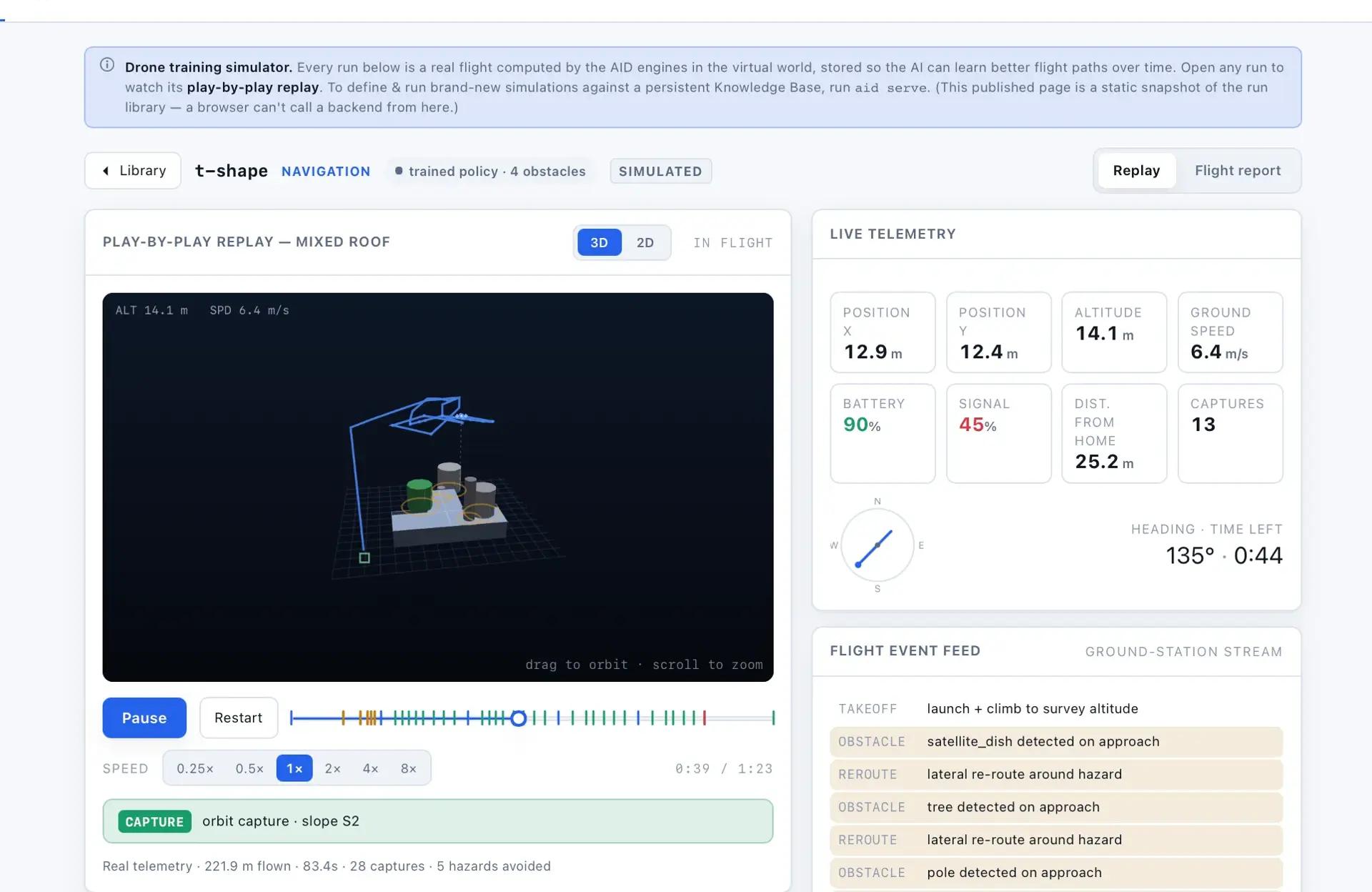
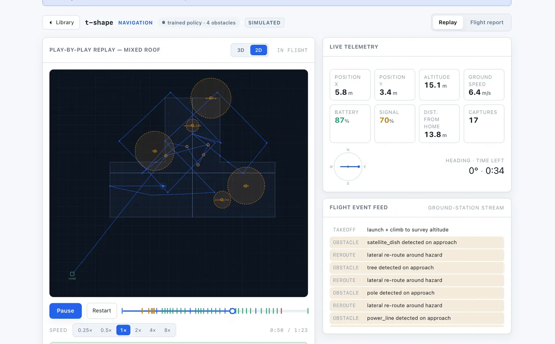
Executes validated mission plans as real-time adaptive drone movement with obstacle avoidance, telemetry streaming, and safety-override abort logic.
Computer Vision Damage EngineInsurance-grade vision
Detects, classifies, and severity-scores spatially anchored roof damage that is material-aware, multi-angle validated, and confidence-traceable.
Uncertainty & Coverage EngineInspection Completeness Score
Tracks what was and wasn't observed, produces uncertainty heatmaps, and blocks reporting or triggers re-inspection until completeness thresholds are met.
Risk & Insurance Intelligence EngineClaim eligibility scoring
Translates detected damage into probabilistic risk tiers, claim eligibility, repair-vs-replacement decisions, cost estimates, and fraud signals.
Reporting & Delivery EngineEvidence traceability
Compiles spatial, damage, uncertainty, and financial data into legally defensible, evidence-linked inspection reports and insurance submission packages.
Fleet & Scaling Coordination EngineGlobal optimization
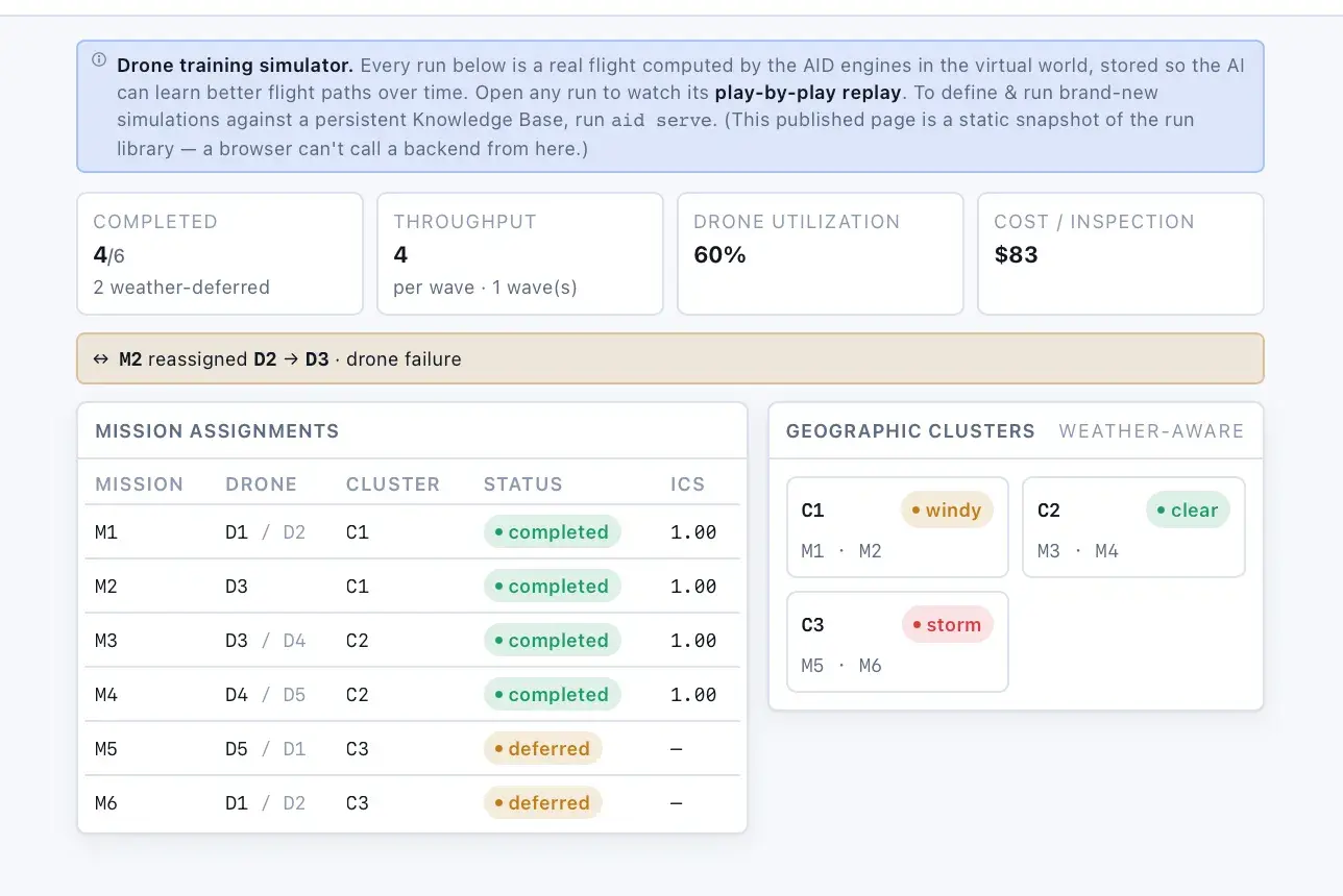
Coordinates many drones and concurrent missions across regions via prioritization, geographic clustering, load balancing, and failover redundancy.
System Orchestration EngineReconciliation mode
Deterministic control layer governing execution order, cross-engine data consistency, conflict arbitration, and the uncertainty gatekeeper.
The 7-phase inspection pipeline
- Mission creation: ingest property and request, generate mission plan
- Spatial modeling: reconstruct roof geometry, segment slopes, detect occlusions
- Flight execution: deploy drone mission, capture pose-anchored data, stream telemetry
- Vision analysis: detect anomalies, classify damage, anchor spatial coordinates
- Uncertainty validation: compute coverage, evaluate confidence, trigger re-inspection if required
- Financial intelligence: compute risk score, estimate cost, determine claim eligibility
- Report generation: compile structured report, attach evidence, export delivery packages
Screens · 8

How it is built
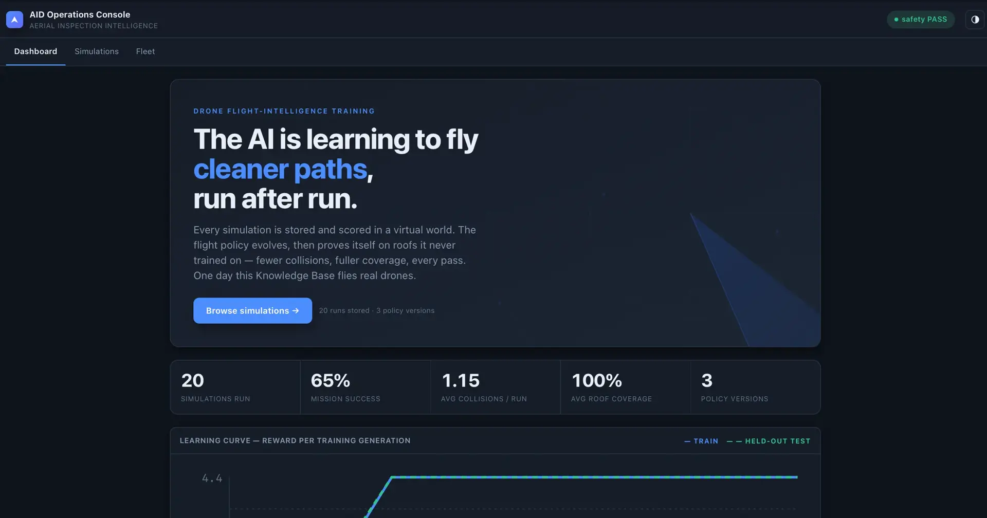
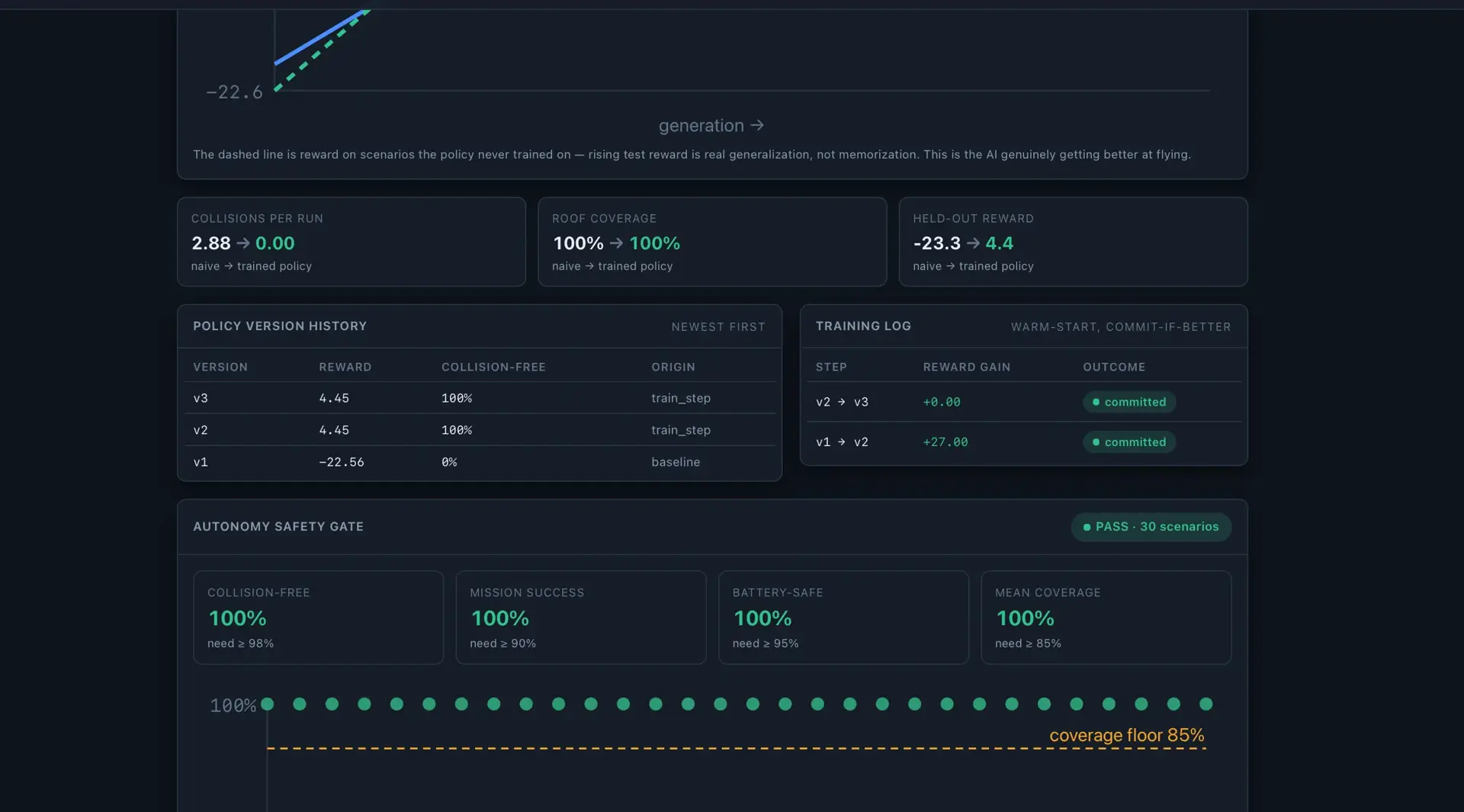
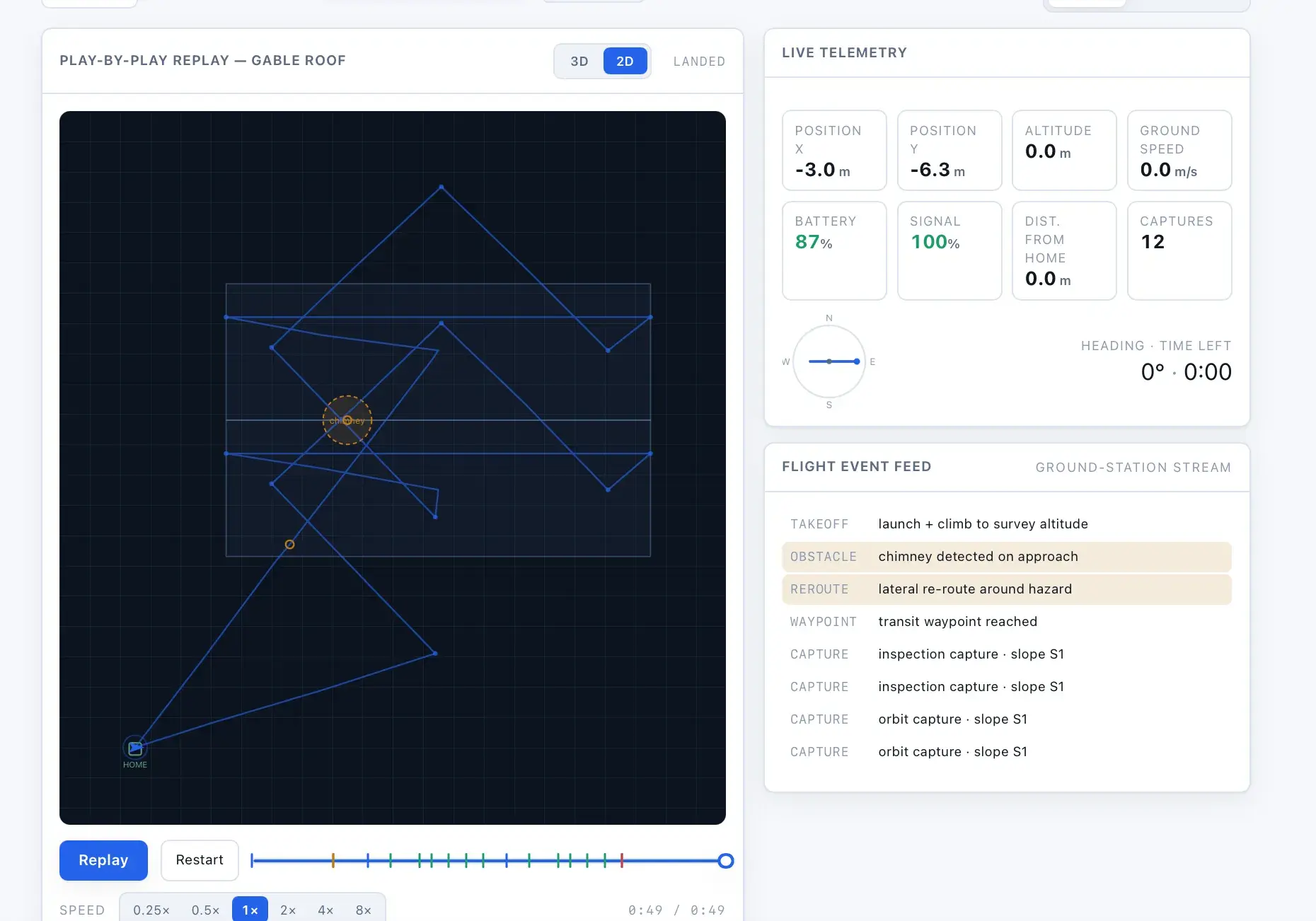
The core is a Python package of engines communicating through typed schema objects, coordinated by an orchestration engine that runs each mission through the seven-phase pipeline. A FastAPI service exposes REST endpoints and serves a browser-based operations and simulation-lab console, while a SQLite database persists missions, simulations, and policy versions. External data and hardware sit behind provider adapters that run as labeled offline stubs until real credentials or implementations are supplied.
Classification
- Industries
- ConstructionHome Services
Related work
PermitPilot AI
Functional DemoAI permit preparation and tracking that moves contractors from project details to permit-ready packets.
AI City Expansion Engine
Functional DemoLocation intelligence that scores ZIP codes by industry-specific expansion opportunity.
Building something with similar Computer Vision, Geospatial Analysis, Financial Modeling functionality?
Start a project and reference this one — the conversation begins with what you have already seen.
Start a project